

Town guide · Essex County
Living in Livingston, NJ
Livingston is a large suburban township in western Essex County, home to Saint Barnabas Medical Center, the Livingston Mall and Riker Hill Art Park.
Livingston is a township of about 14 square miles in western Essex County, the second-largest town in the county by area, with 31,330 residents at the 2020 Census.
It was incorporated in 1813 and named for William Livingston, New Jersey's first governor. Livingston grew quickly once cars arrived in the 1920s, and today it is a large suburban township with a major medical center, a busy town center and more than 470 acres of wooded parks.
Neighborhoods and areas
Why people choose Livingston
Healthcare hub
Saint Barnabas Medical Center is one of the area's major employers.
Everyday convenience
The Livingston Mall and Northfield Avenue shopping close by.
Space
Larger lots and single-family homes, from mid-century ranches to new construction.
Living in Livingston
Getting around
Livingston is a driving town: I-280, Route 10 and the Eisenhower Parkway serve the township, and I-280 connects to I-80, the Garden State Parkway and the Turnpike. There is no train station in town; the closest are Short Hills, Millburn and South Orange on the Morris & Essex Line, about five to seven miles away. NJ Transit buses run to Newark, and Community Coach route 77 runs to the Port Authority Bus Terminal.
Parks and outdoors
The Riker Hill complex covers about 205 acres, including Riker Hill Art Park, an Essex County park on a former military site where the old buildings now house artist studios. Memorial Park and the Oval host free summer concerts at the gazebo, and Haines Pool, next to the high school, is the township pool.
Downtown and everyday life
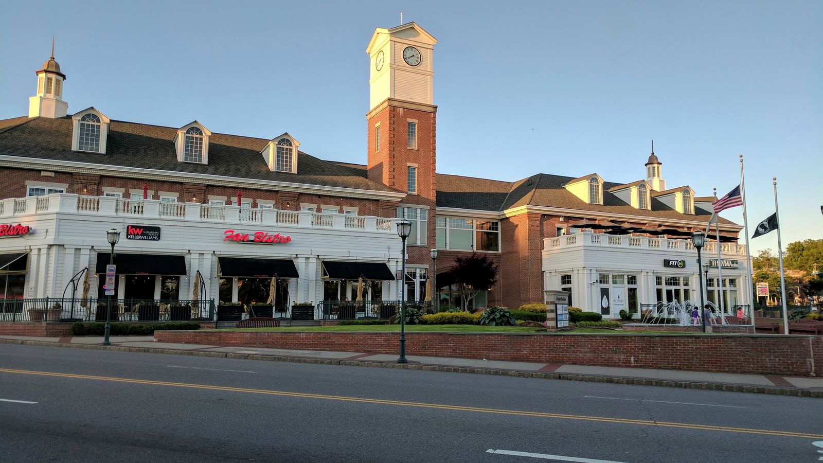
Livingston Town Center on Livingston Avenue is a mixed-use center with restaurants and an Arts Council gallery, and the Livingston Mall is the regional shopping center. The township calendar includes a Memorial Day parade to the Oval, a Haunted Walk and a holiday craft fair.
Schools
Livingston Public Schools serve about 6,000 students in nine schools: six elementary schools, Mount Pleasant Middle School (grade 6), Heritage Middle School (grades 7 and 8) and Livingston High School. Newark Academy, an independent school, is also in town.
History and landmarks
Cooperman Barnabas Medical Center (formerly Saint Barnabas) moved to Livingston in 1964 and is one of the area's major hospitals. The Ward-Force House and Condit Family Cook House on South Livingston Avenue is on the National Register and run as a museum by the Livingston Historical Society.
Livingston market snapshot
All residential sales in ZIP 07039, March 1 to May 31, 2026. Source: Redfin. Ask me for this month's numbers.
Livingston questions buyers ask
Does Livingston have a train station?
No. The closest NJ Transit stations are Short Hills, Millburn and South Orange on the Morris & Essex Line, about five to seven miles away. Community Coach route 77 runs to the Port Authority Bus Terminal.
Is there a hospital in Livingston?
Yes. Cooperman Barnabas Medical Center, formerly Saint Barnabas, is on Old Short Hills Road.
Which public schools serve Livingston?
Livingston Public Schools: six elementary schools, Mount Pleasant Middle School, Heritage Middle School and Livingston High School, serving about 6,000 students.
Does Livingston have a town pool?
Yes. Haines Pool on Wahler Road, next to Livingston High School, is the township pool.
Working with Pete
Pete Moriello is one of the most reliable and skilled real estate professionals I've worked with in my career. We've partnered for many years, and he consistently demonstrates exceptional care for his clients.
Pete kicked ass with helping me sell my home. I will recommend him to anyone buying or selling their property. He helped me every step of the way!!
He is very professional, kind, and respectful. He communicates clearly and makes the process easy to understand. He is helpful, trustworthy, and always willing to answer questions.
More towns
Top photo: Livingston Town Center by Scott Brody, CC BY-SA 4.0, via Wikimedia Commons.